-
E-mail
lixinghua@yunjingtianhe.com
-
Phone
13276363035
-
Address
Building 1, Weifang High tech Zone Optoelectronic Industry Accelerator (Phase I), No. 155 Guangdian Circuit, Weifang High tech Zone, Shandong Province
Shandong Tianhe Environmental Technology Co., Ltd
Which is a good handheld meteorological instrument? Yunjing Tianhe can help prevent agricultural disasters such as wind and frost damage
Date: 2025-12-18Read: 8
Model recommendation: TH-SQ6Manufacturer of meteorological and environmental monitoring instruments and equipment, Yunjing Tianhe supports customized services for merchants. You can rest assured when choosing Shandong Yunjing Tianhe's handheld meteorological instrument. Yunjing Tianhe helps prevent agricultural disasters such as wind and frost damageThe integrated design of some models adopts a six element integrated sensor, which integrates the measurement functions of multiple meteorological elements into one device, simplifies the operation process, and improves measurement efficiency. Intelligent data processing with built-in high-performance intelligent chips enables multi-dimensional synchronous monitoring and data processing of meteorological elements. Some devices also have edge computing capability, which can realize real-time data calibration, outlier filtering and other functions. The low-power design adopts dynamic power management technology to reduce device power consumption and extend battery life. Some devices support solar power supply systems and can operate continuously in rainy weather for multiple days. The high protection level shell is made of high-strength materials, with a protection level of IP65 or higher, which can resist harsh environments such as salt spray, sand and dust, and strong ultraviolet rays. Elephant forecasting and environmental monitoring provide accurate data support for meteorology, helping users to timely understand weather changes and make scientific decisions. Meanwhile, it can also be used in the field of environmental monitoring to monitor environmental parameters such as air quality and pollution dispersion.
1、 Product Introduction
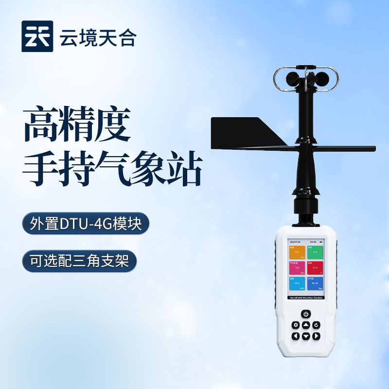
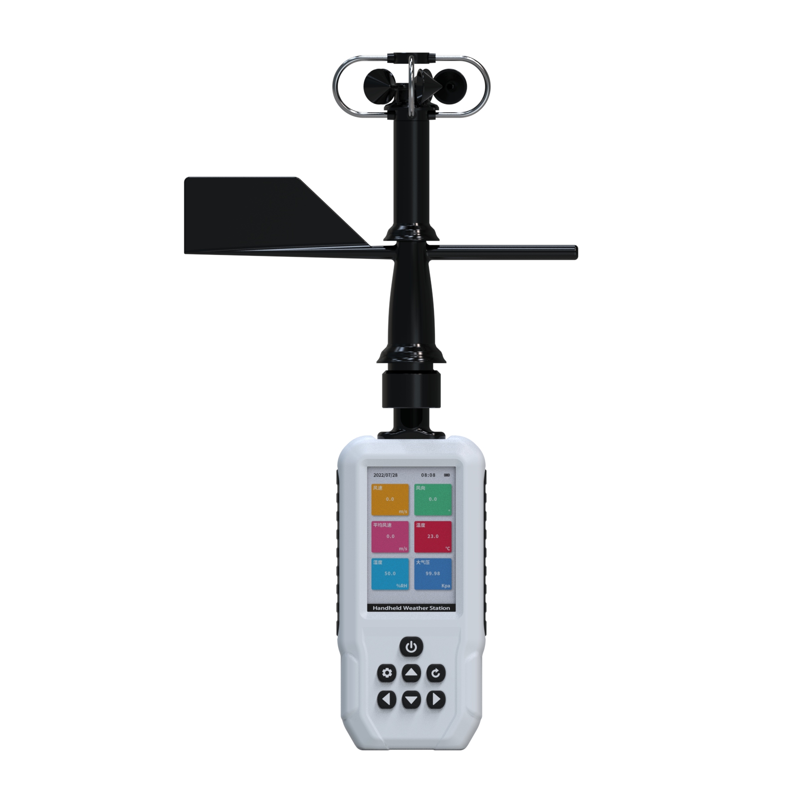
Handheld meteorological station, also known as handheld meteorological instrument, is a portable and easy to operate mobile meteorological observation instrument that integrates multiple meteorological elements. The system adopts precision sensors and smart chips, which can accurately measure the wind speed, wind direction, average wind speed, temperature, humidity, atmospheric pressure, altitude, thermal index, wet bulb temperature, wave height, dew point temperature, wind chill index, GNSS the third mock examination positioning and other elements at the same time. The built-in large capacity FLASH storage chip can store meteorological data for at least one year; Type-C communication interface, convenient for users to further process and analyze meteorological data.
This instrument can be widely used in fields such as meteorology, environmental protection, airports, agriculture and forestry, hydrology, military, warehousing, scientific research, etc.
2、 Functional Features
1. The 3.5 inch LCD screen can display wind speed, wind direction, average wind speed, temperature, humidity, atmospheric pressure, altitude, thermal index, wet bulb temperature, wave height, dew point temperature, wind chill index, GNSS the third mock examination positioning and other elements. ☆
2. Equipped with an electronic compass, it enables 360 degree monitoring of wind direction and adds the option to switch between automatic and manual wind direction modes. ☆
3. Large capacity data storage, capable of storing up to 40000 meteorological data (data recording intervals can be set between 1-60 minutes).
4. Type-C communication interface for reading internal stored data. ☆
5. GNSS the third mock examination positioning has high precision and fast speed (single Beidou is optional). ☆
6.3800mAh lithium battery, low-power design, long standby time, and 18 hours of operation. ☆
7. The structural design is scientifically reasonable and easy to carry.
8. External DTU-4G module, uploaded to cloud platform. The 4G module can be plugged in and removed at any time to replace the IoT network card. ☆
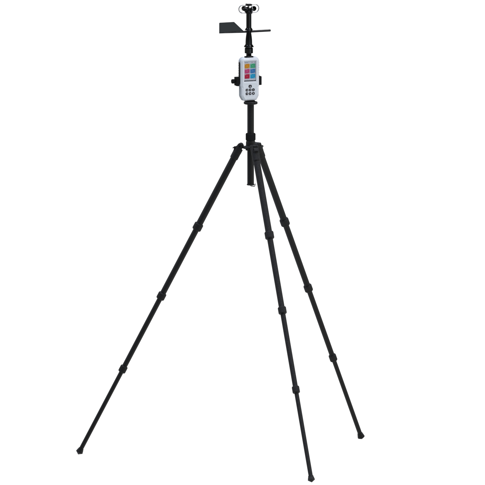
9. Optional triangular bracket.
3、 Technical parameters
| meteorological parameters | Measurement elements | measurement range | precision | resolution | unit |
| wind speed | 0-60 | ±0.3 | 0.01 | m/s | |
| wind direction | 0-360 | ±3 | 0.1 | degree | |
| average wind speed | 0-60 | ±0.3 | 0.01 | m/s | |
| temperature | -40-125 | ±0.2 | 0.1 | ℃ | |
| humidity | 0-100 | ±2 | 0.1 | %RH | |
| atmospheric pressure | 30-110 | ±0.1 | 0.01 | KPa | |
| altitude | 0-9165 | ±1 | 1 | m | |
| Thermal Index | -40-140 | ±0.2 | 0.1 | ℃ | |
| wet-bulb temperature | -29-70 | ±0.2 | 0.1 | ℃ | |
| wave height | 0-14 | ±0.2 | 0.1 | m | |
| dew point temperature | 0-70 | ±1 | 0.1 | ℃ | |
| wind-chill index | 0-5 | ||||
| GNSS | The third mock examination positioning | ||||
| screen | 3.5-inch LCD screen | ||||
| battery | 3800mAh lithium battery | ||||
| communication | Type-C port | ||||
| DTU-4G upload to cloud platform | |||||
| storage | 40000 pieces of data | ||||
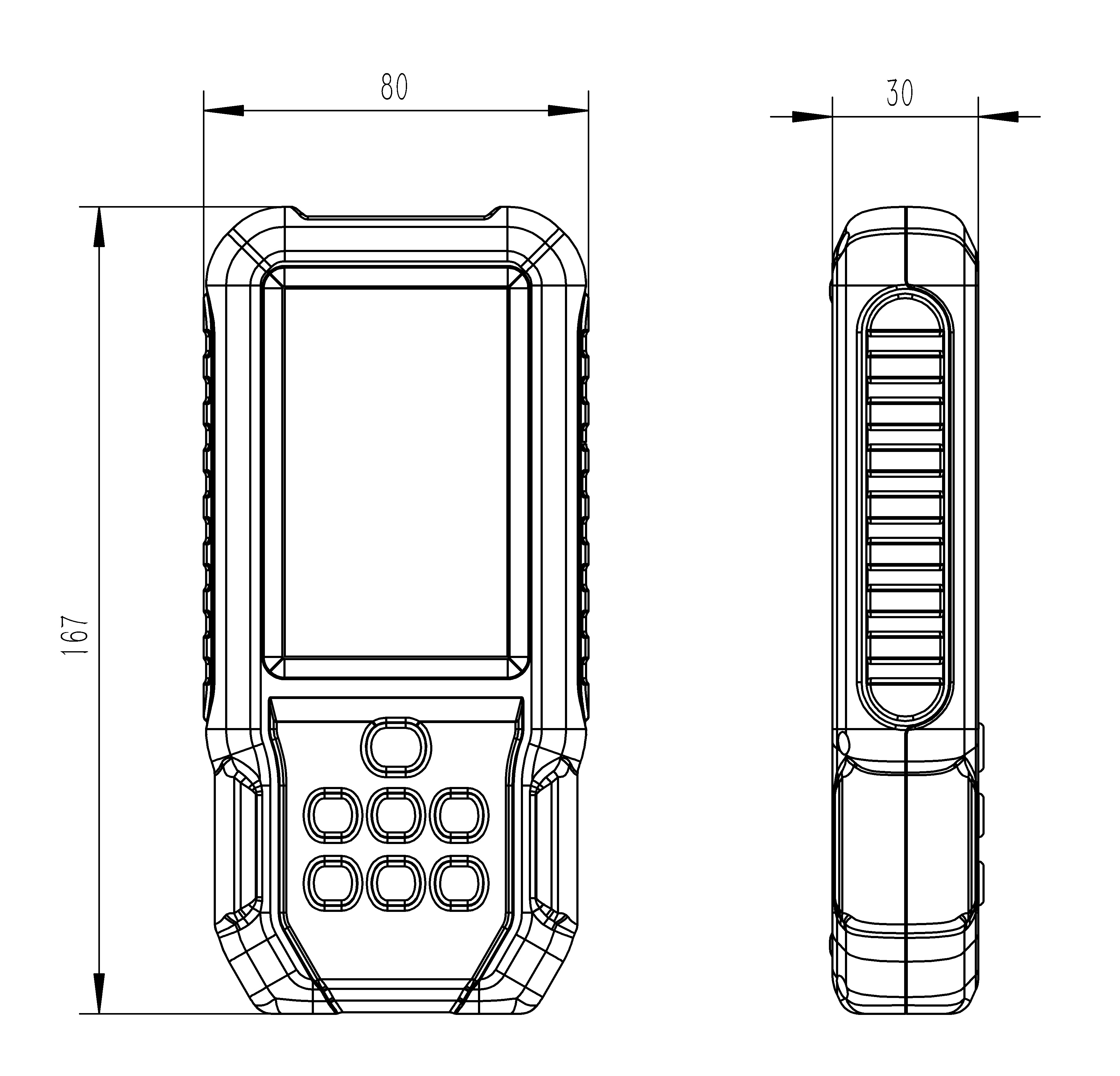
| host size | 167*80*30mm | ||||
| Overall dimensions | 370*208*80mm | ||||
| Total weight | 363.2g | ||||
4、 Configuration Description
| Model elements | SQ3 | SQ6 | SQ8 | SQ9 | SQ10 | SQ11 | SQ6+ | SQ8+ |
| wind speed | √ | √ | √ | √ | √ | √ | √ | √ |
| wind direction | √ | √ | √ | √ | √ | √ | √ | √ |
| average wind speed | √ | √ | √ | √ | √ | √ | √ | √ |
| temperature | √ | √ | √ | √ | √ | √ | √ | |
| humidity | √ | √ | √ | √ | √ | √ | √ | |
| atmospheric pressure | √ | √ | √ | √ | √ | √ | √ | |
| altitude | √ | √ | √ | √ | √ | |||
| Thermal Index | √ | √ | √ | √ | √ | |||
| wet-bulb temperature | √ | √ | ||||||
| wave height | √ | |||||||
| GNSS the third mock examination positioning | √ | |||||||
| dew point temperature | √ | |||||||
| wind-chill index | √ | |||||||
| 4G upload | √ | √ |
5、 Appearance and size
6、 Whole box accessories
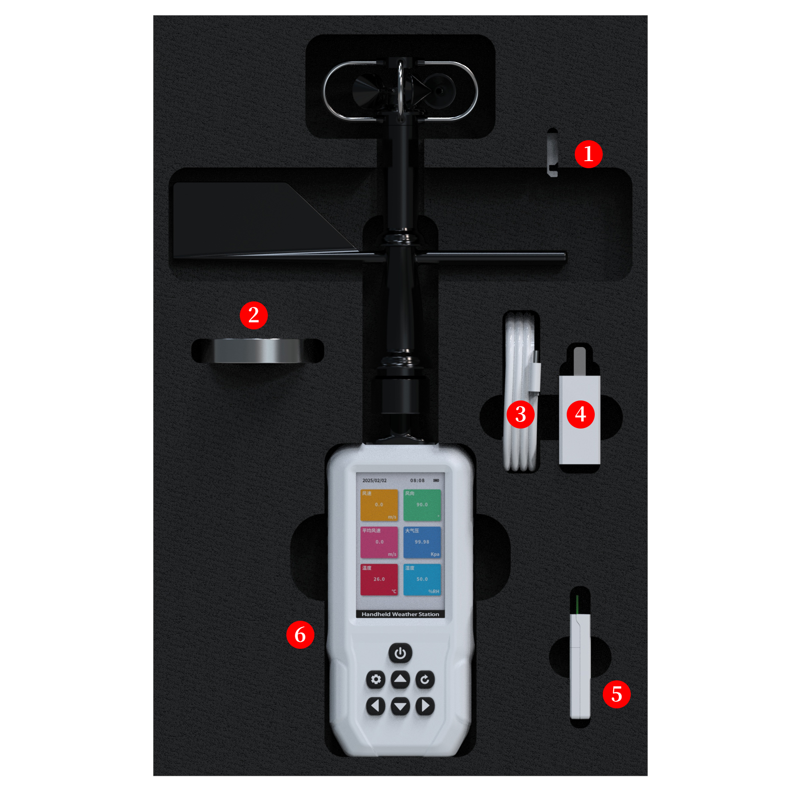
① Wind direction calibration accessories
② Compass
③ Data cable
④ Charging head
⑤ DTU-4G upload module
⑥ Host
7、 Optional bracket